The vadose zone is the interval between the crop root zone and the water table, and is a critically important region for storage, transport and transformation of chemicals that can impact groundwater quality.
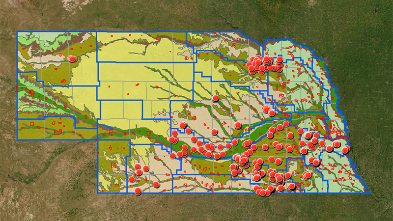
This interactive map depicts the locations where measurements of nitrate and other agrichemicals, such as pesticides and heavy metals, have been recorded in the vadose zone in Nebraska. To examine data at a specific location, zoom to the location of interest and click on the corresponding dot. A popup with relevant information and links to data will appear. You may also search by entering county, latitude and longitude, legal description, Natural Resources District or core ID in the Search box.
Information on the significance of the vadose zone, the purpose of vadose zone monitoring, and citation instruction is available. Discover more about the Vadose Zone.
The Nebraska Vadose Zone program standardizes collection, processing, analysis, and sharing of vadose zone monitoring data. Standard operating procedures, quality control plans, training videos and other resources are available. See our guidance.
The database is a repository for historic and current monitoring data. Many partners contribute to the Nebraska Vadose expansive public dataset, and more are always welcome. Share your data.
Please send questions or comments to nebraskavadose@unl.edu.